

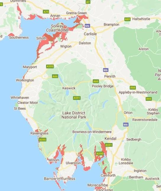
Scientists have produced an interactive map which allows you to see which areas of the Cumbria region could be predicted to be underwater and at risk of flooding by 2030.
The map, made by non-profit Climate Central, projects the areas throughout the world that are likely to be most affected by rising sea levels and coastal flooding.
The idea behind the map is to identify which areas will need to look into further flooding protection and planning to help avoid costs to those most vulnerable to the consequences of climate change.
The map works as a screening tool by using a combination of artificial intelligence, elevation data and the latest sea level predictions to identify areas at-risk however, it should be stated that the projections do not take into account current coast and river defences.
When looking at the map, the areas shaded red are projected to be below annual flood level by 2030.
The screening tool indicates large patches of the both Copeland and Allerdale region are at risk along with areas of the South Lakeland, including Ravenglass and Millom.
Unsurprisingly, along Cumbria's North West coast line is the most obvious at-risk of rising sea levels, with notable sites set to be vulnerable to flooding such as Sellafield and St Bees.
Looking specifically however, according to the map, we can see that the town of Whitehaven, in particular it's port, will be in need of further flooding protection.
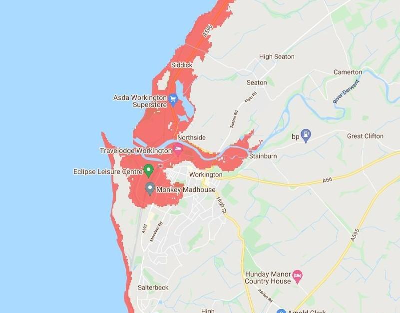
Travelling north from this route, the map shows large swathes of a vulnerable area in Workington in need of potential safeguarding, coinciding with flooding along the banks of the River Derwent.

According to the data, the town of Maryport is in a similar affected situation, with the North Allerdale region of particular vulnerability, identifying it as an at-risk area.
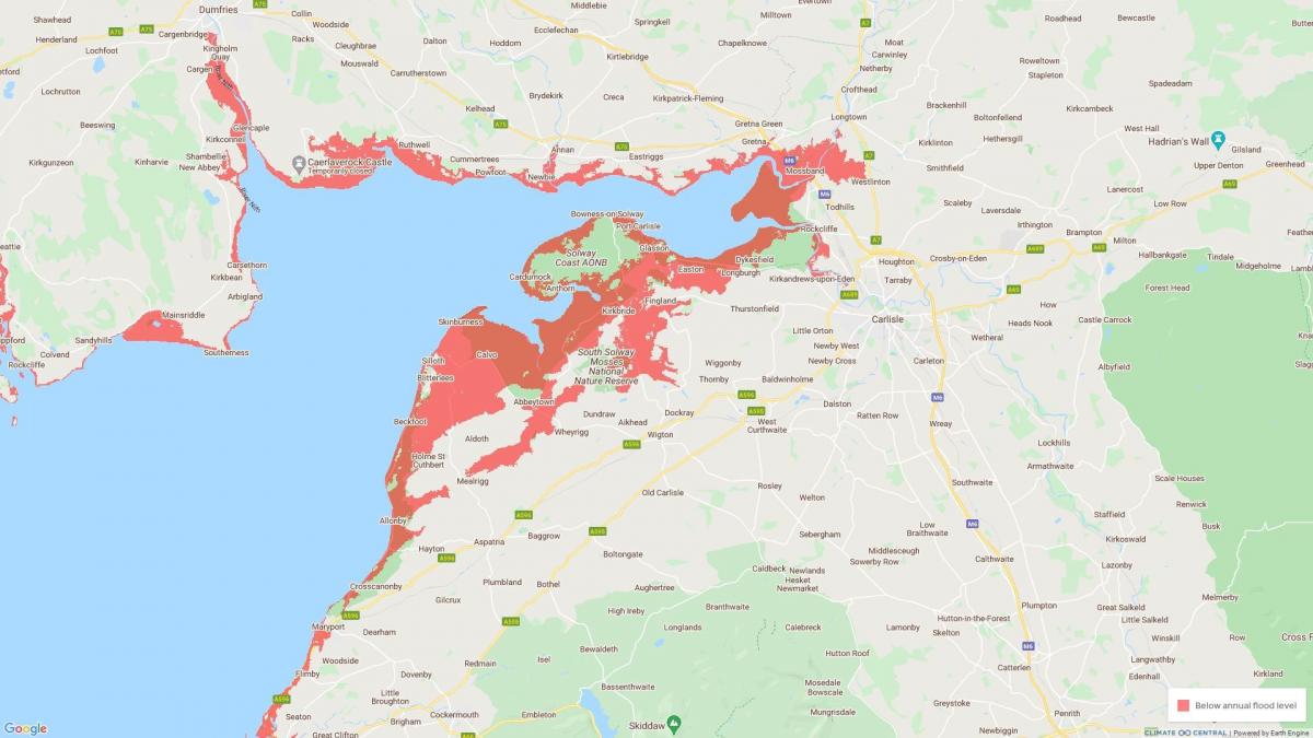
When we consider the north west's most populous region, Carlisle, fortunately we can see that the city will be relatively flood-free come eight years time.
However, flooding along the banks of the River Eden has the potential to alter the nearby landscape, in particular from Rockcliffe towards the Kingmoor Nature Reserve.
The further inland we travel, towns such as Keswick, Cockermouth and Penrith avoid the need for immediate safeguarding against global warming.
To view the interactive map, click here.


Comments: Our rules
We want our comments to be a lively and valuable part of our community - a place where readers can debate and engage with the most important local issues. The ability to comment on our stories is a privilege, not a right, however, and that privilege may be withdrawn if it is abused or misused.
Please report any comments that break our rules.
Read the rules hereLast Updated:
Report this comment Cancel